
Maps of Astrakhan' area
Maps for my proposed campaign. They have been reduced in size to fit on the page.
The General Area
The circle is the areas in the real world where I intended to set my campaign. One side would hold the north (probably the Reds) and one the south.
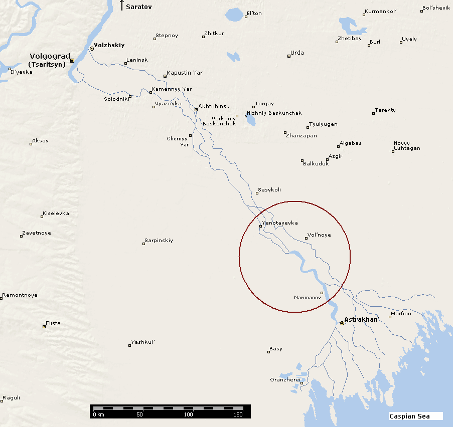
I chose this area because the lower Volga is limited on both sides by arid steppes (deserts really) so that all troop movements were basically confined to a narrow corridor. This meant the campaign could quite historically ignore what was happening on the flanks.
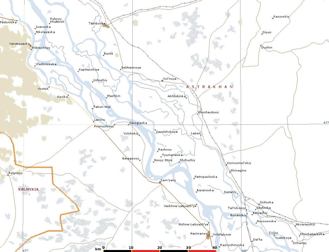
This can clearly be seen in a closer look at the area, two deserts surrounded by a narrow band where the Volga and Aktuba rivers meander and mix:.
However real maps are a pain to use in campaigns, as it is really hard to fix reference points and determine movement rates. So I converted the map above into a schematic version, based on 10 by 10 kilometer squares (shown as rectangles to make it easier to read).
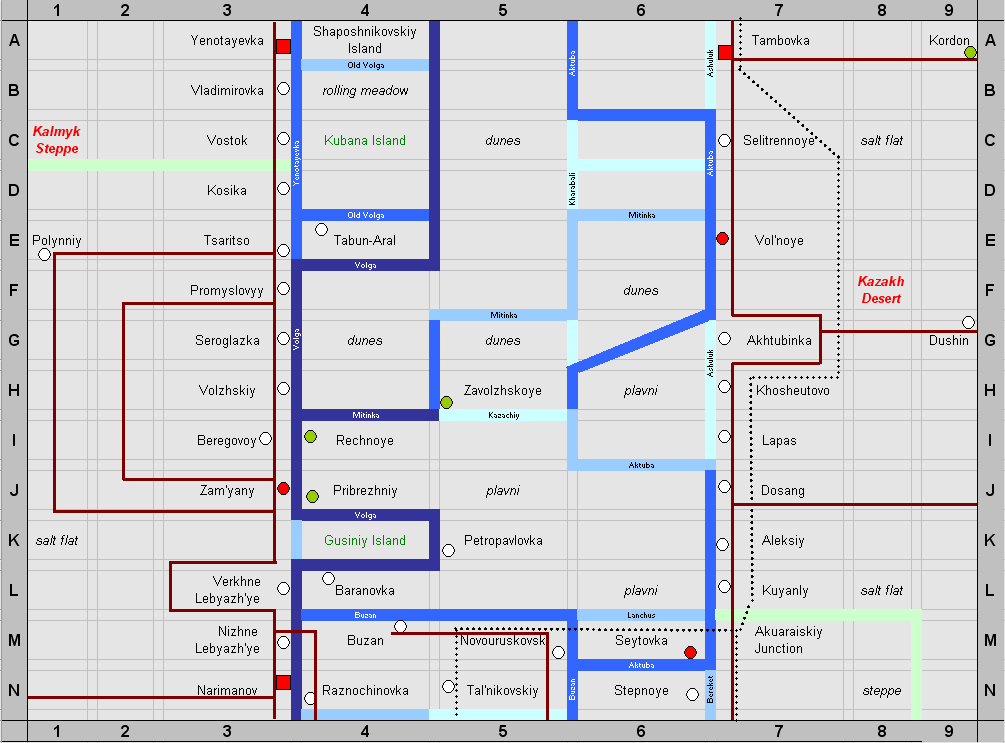
The squares indicate towns, with some ability of fix cars, planes etc, while the circles are villages with little more than farming and fishing going on. The colour of each village/town indicates its main political leaning – mostly White as we are in Cossack territory. The black dots are the rail line, and the brown the main roads. Italic indicates terrain type.
The darker the blue, the deeper the river, so that the palest bits are little more than streams, while the main channels are about a kilometre wide. This is important, as both sides fielded fleets, and the Reds at least used theirs frequently to assist the land forces.
This map "corrected" the real world a bit. Firstly it is twisted slightly, so that the campaign will run North-South, rather than slightly on an angle. Then I made sure that towns were no more than 2 squares from each other. A couple needed renaming as Lenino and Komsomol'skiy cannot have been their 1919 names (sadly I had to make up names, as I could not find their real ones).
Maps of individual towns
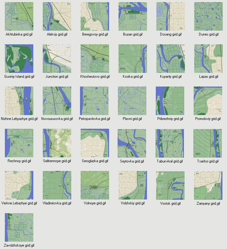
I drew up a gif map of every town in the map except those on the outer rows and columns (as these were unlikely to be the scene of very much fighting).
I based them on 1960's Soviet topographic maps, so the general shape of the ground is pretty accurate. Exactly which roads and tracks were present in 1919 was always going to be speculative, but they don't affect fighting much anyway. I cut down the size of the towns but only reduced the size of the villages a bit (though any new "colonies" or apartment blocks were chopped, obviously). The nature of any crops at that time was necessarily even more speculative, but the very absence of crops that form major impediments was one of the reasons I chose the area in the first place. (I placed lots of rice fields, but late in the year these are merely flat ground, although any ditches might make impromptu trenches.)
I also drew up a couple of maps for generic terrain. The steppes were omitted as too simple to need doing – plain boards, either dead flat or gently rolling according to their type.
Each map is drawn with a grid of 1 by 1 kilometre on it. They are large because I wanted the sides to have some options about how they attacked or defended. Obviously I am not going to set up boards of the full size of these maps, but will take a suitable portion once the players have indicated their positions and intentions.
Links to gifs of each map
Aktubinka, Aleksiy, Beregovoy, Buzan, Dosang, Guisiniy Island, Junction, Khosheutovo, Kosika, Kuyanly, Lapas, Nizhne Lebyazhye, Novourusovka, Petropavlovka, Pribrezhniy, Promsloviy, Rechnoy, Selitrennoye, Seroglazka, Seytovka, Tabun-Aral, Tsaritso, Verkne Lebazhye, Vladimirovka, Volnoye, Volzhskiy, Vostok, Zamyany, Zavolzhskoye,
Dunes (i.e. any rolling bit between the rivers), Plavni (i.e. any flat bit between the rivers)
Or, a zip file of all of them (nearly 10 MB)